Siniloan Laguna Best Hiking Trail Near Manila [Comprehensive Guide]
Written by Dezza 27 December 2017.
One of the things that really motivated me to start a concept similar to Deztiki was to show my expat friends in particular, that so many of the best places in the Philippines are actually right on the doorstep of Manila.
The province of Laguna in the Calabarzon Region is definitely one of those places that offer so many things to see and do.
If you have been following the Deztiki blog series, you will have seen some of the places that we have been to are mainly in Laguna province, particularly on the outskirts of Laguna De Bay.
This includes some amazing places like Mt Romelo, Buntot Palos Falls, Hidden Valley Springs and our most recent adventure, Hulugan Falls.
On this occasion, it was time to explore another area known as Siniloan Laguna, which is almost on the border of Famy Laguna.
I read here about Siniloan Laguna while doing my customary research which led me to Buruwisan Falls at Mt Romelo, also in Siniloan. I was immediately captivated and was eager to explore this place for myself.
As usual, I told several friends about this and before I knew it, there were around 30 people who were interested to join me. This, of course, required us to hire a bus in order to accommodate everybody.
Having read about Siniloan Laguna, it came across as a place that may be difficult to find. However, there is a registration area at a place called “Trekkers”.
The entrance to Trekkers is at KM17 on the Siniloan-Famy-Infanta Road. It can be a little tricky to find so you really you need to look out for it as it is on a bend.
Luckily, unlike a lot of other Philippines destinations, there is a sign there “Trekkers”.
Let the fun begin
Once there you will find a small kiosk. You need to look out for the legendary, and very friendly, Ma’am Luz Saldivia, owner of the area. She and her family have been living in Siniloan Laguna for decades.
She will give you a brief explanation of the area and assist you to get going. Once you register you will then be assigned a guide. This makes things a lot easier for you as signage on the hike itself is non-existent.
From there, our first stop off was the majestic Kalawang Falls. This is only about a one-kilometre walk down the main road. Then you go off-road onto the hiking trail.
The hike isn’t overly difficult in terms of the incline, although some parts were fairly tough. There was a river crossing about halfway, in which you can expect to get your feet wet. The hike to the falls was about 30-40 minutes.
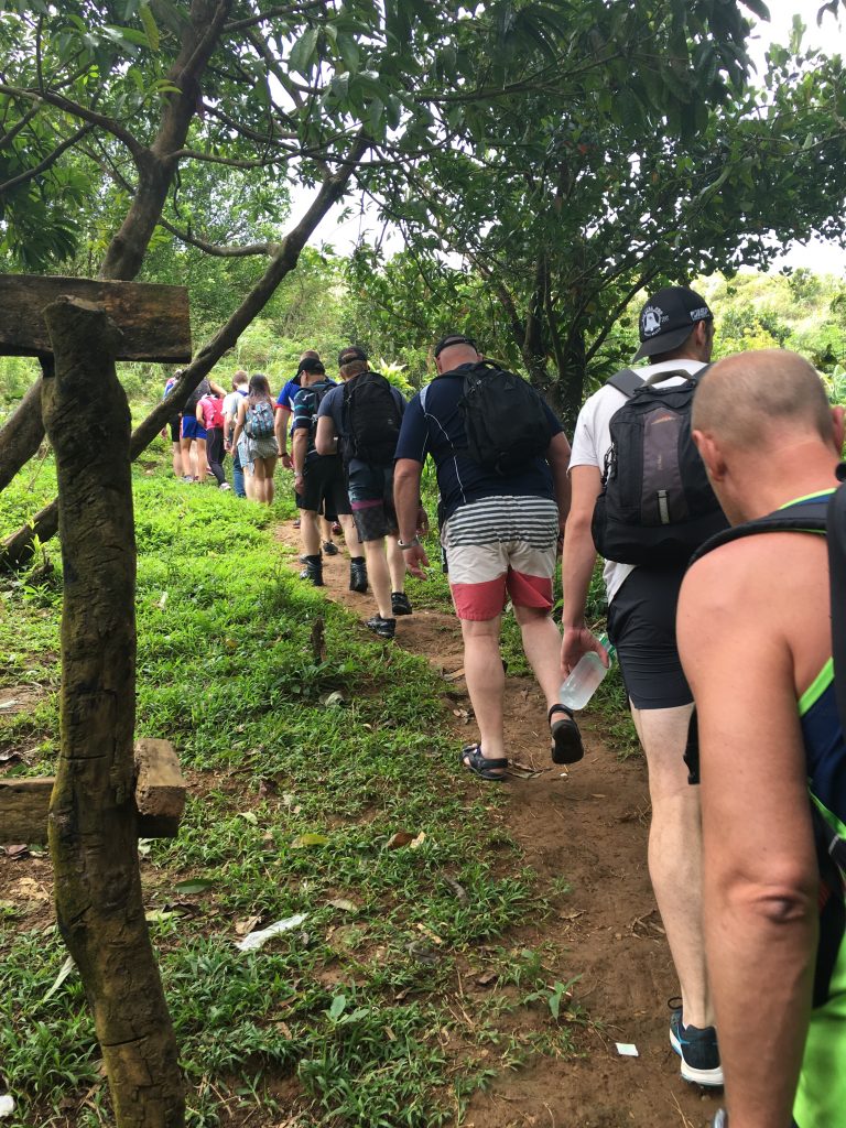
This is the start of the off-road trail to Kalawang Falls. As you can see its a decent trail but a rain shower came through and made it a little slippery.
This was a beautiful multi-tiered waterfall that cascades down the rocks and into the river below. If you didn’t have the local knowledge you would have no idea that it was there. Unlike other waterfalls, it isn’t really set into a cliff face.
The overall height of the waterfall is about 20 metres but it is deceptive as it is multi-tiered. From there we headed back to the vehicle and back up towards the registration area to commence the hike to Hagdang Bato Falls and Tulay Na Bato Falls. This is on a separate trail.
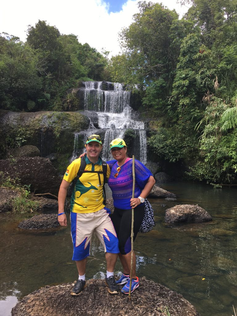
The missus and I at Kalawang Falls. As you can see, the falls cascade down the rocks beautifully, but the water isn’t the best for swimming in.
Back to the beginning
The first part of this trek is on a sealed road but you soon reach the off-road trail. Once again there is a river crossing in which you can expect to get your feet wet.
Aside from the river crossing the rest of the hike is not overly challenging. The trail doesn’t have too much of an incline and is fairly well established.
After about 45 mins, you come across Hagdang Bato Falls. The trail comes out at the foot of the rapids, which then continue upstream for a kilometre or so.
These are some of the most spectacular, continuous rapids I have seen in the Philippines. It is like one continuous multi-tiered waterfall up to that point.
The view from the foothills of the rapids is amazing as you’re looking across the Sierra Madre mountains and a valley. And there is not a single person in sight!
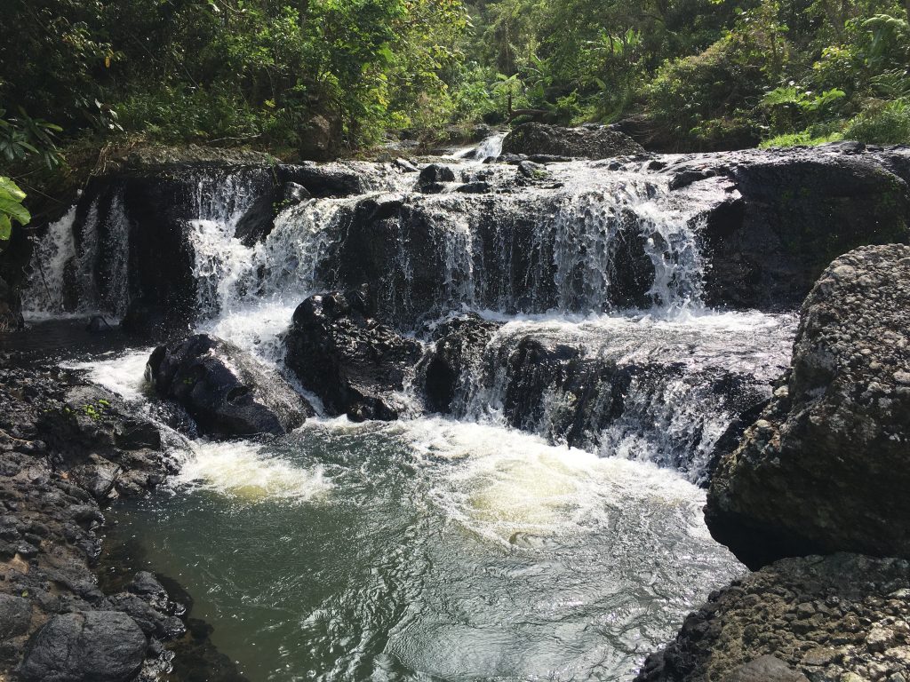
These rapids continue upstream for maybe one kilometre or so and are sensational. It’s like one long continuous waterfall.
What a place to eat lunch!
This was where we hung out for half an hour or so and had lunch. From there we continued on a gradual ascent upstream passing several mini waterfalls set amongst the rapids as you make your way to the final stop, Tulay Na Bato Falls.
There are several water crossings along here, with plenty of boulders to stand on which allow for a fairly easy crossing. However, there are a few tricky inclines to negotiate in which you will require a hand.
After an hour or so of hiking up the rapids, you reach the majestic Tulay Na Bato Falls.
The final ascent to this waterfall is quite difficult due to the slippery rocks and boulders, so you do need to exercise some caution and patience.
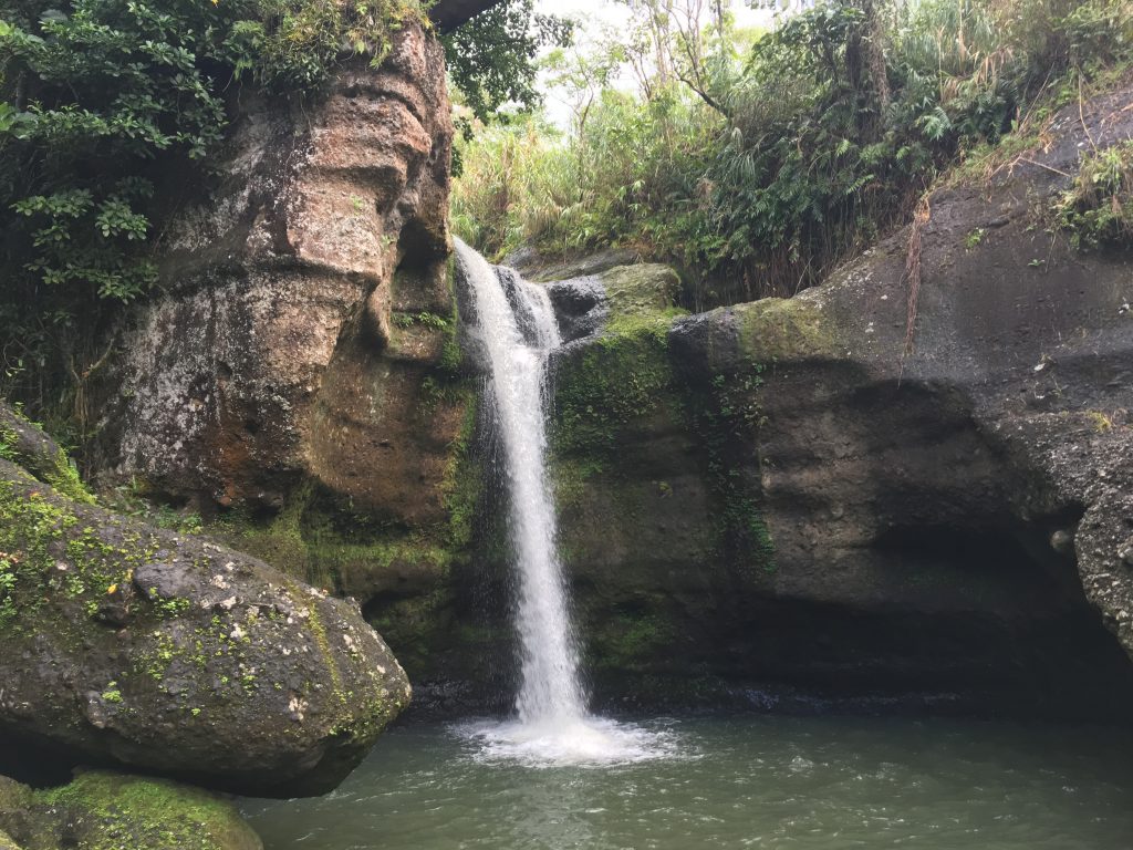
This is one of the more unique waterfalls I have seen. The rock formations look like they have almost been sculptured by an artist.
Thrill-seekers will jump
The basin of the fall is quite small, but it’s deep enough to dive into from the top of the falls for the real thrill-seekers. A couple of the younger guys climbed up to the top of the waterfall and jumped off into the basin.
My heart was certainly in my throat watching them do this, but it was quite safe. Rather than attempt to jump off the top, I decided to ease myself into the basin from the edge of the rocks.
The water is so cool and refreshing, after working up a sweat to reach this spectacular waterfall.
Trying to work your way into the basin and can be fairly difficult as the rocks around the basin are quite big which means you basically do need to jump to reach the water.
However, climbing out is a little challenging but manageable. We stayed here for around about 30 minutes before returning along a different trail back to Trekkers.

Pre-departure photo at Trekkers kiosk and registration area. There are snacks and drinks available but I recommend to BYO.
The total hike isn’t for the faint-hearted in Siniloan Laguna. I would rate it about a 7/10 for difficulty. It is a bonus if you are fairly fit and semi-experienced as a hiker.
However, the guides you are provided with are most helpful and worth their weight in gold. My suggestion is to give yourself plenty of time. That way, you don’t need to rush which will make your trip a lot more enjoyable and safer.
This was certainly one of the most enjoyable that I’ve done. It was challenging without being overly difficult. All three waterfalls we visited were absolutely amazing in their own special way.
Fast Facts
Google Maps: Siniloan (Hagdang Bato Falls)
If you take in all of the above, you will be assigned with a guide. As usual, there is no set fee for the guide, but a tip of P250 would be acceptable. One guide is good for about 8-10 people. There is also an entrance fee of P30.
Trekkers is located at KM17 on the Siniloan-Famy-Infanta Road, which is about 80kms from Makati, or about 3hrs drive via R-5 Road. You need to look out carefully for the Trekkers sign.
From what I have read, there is only one bus line that passes through the area. This is Raymond Bus Lines and the terminal is in Sampaloc, Manila.
Take the bus bound for Infanta in Quezon Province. The drop off point would be Trois Restaurant in Siniloan Laguna, and you would then need to take a jeepney to Trekkers at KM17. Cost should be less than P300.
Related Videos:
If you enjoyed this article, please feel free to make comments below and share with friends and family. Please also check out my related articles below.
Related Articles:
Nagpatong Rock Travel Tips & Advice When Visiting
Why you should go hiking at Mt Romelo


